SUAS Aviation
Take to the skies with drones

The ultimate nexus of modern technology
Welcome to the RyanCooper.com SUAS Aviation Resources page. I have an FAA part 107 pilot license and a Commercial Drone Certification from SRJC. This page contains resources related to part 107 testing, FAA resources, aerial videography and drone related news and resources.
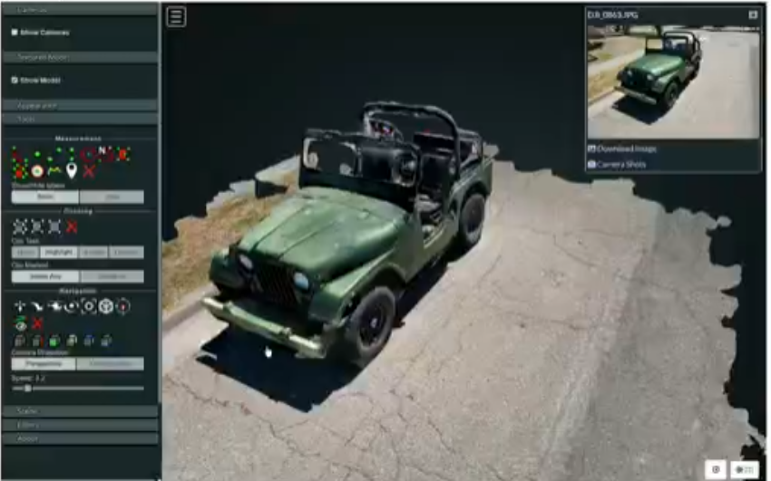
STS Layer Visualizer
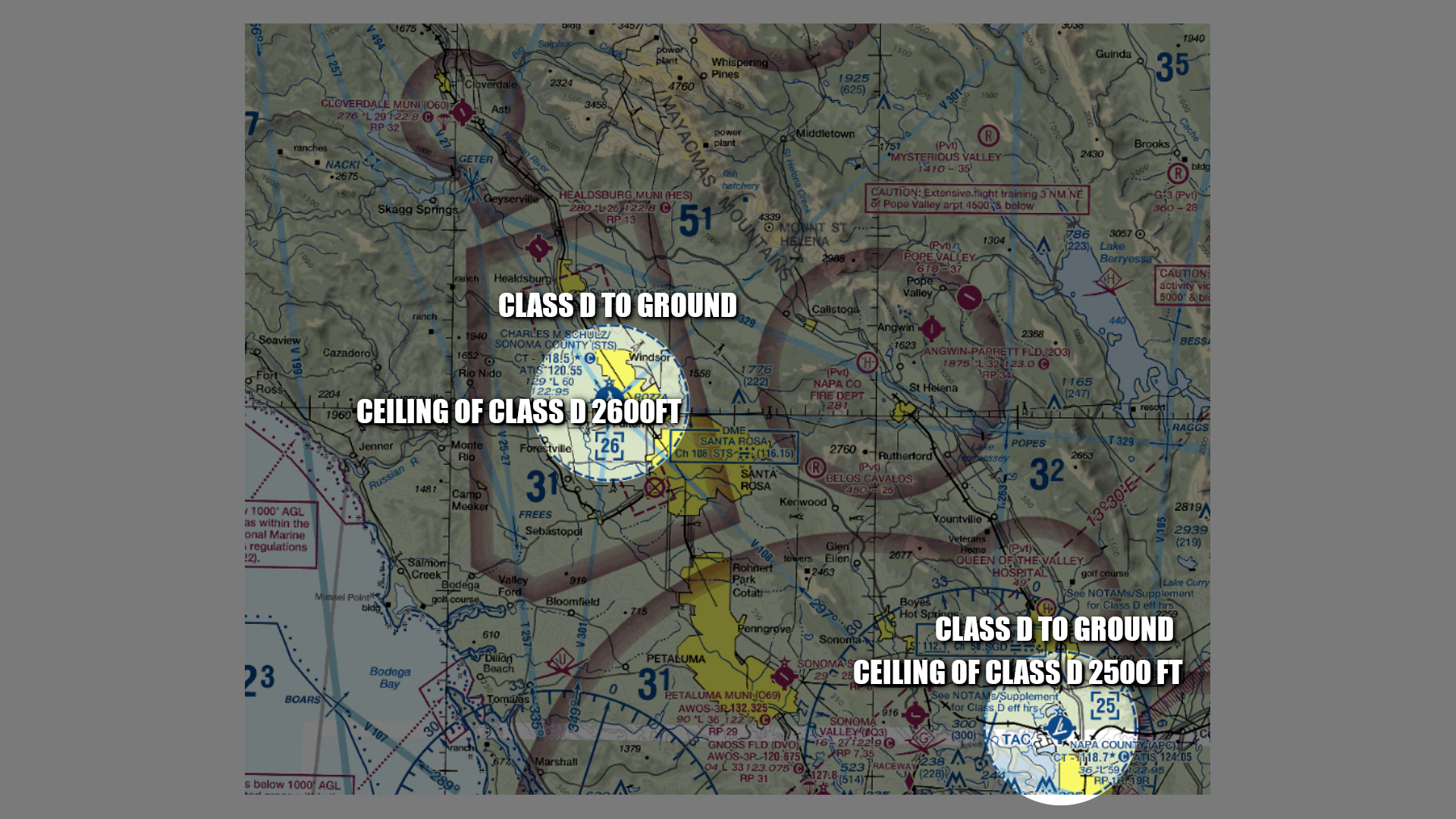
A layer visualizer tool to help sift through the enormous amount of data on our local aiport (STS) and surrounding sectional chart features.
STS Layer VisualizerAviation Links & Resources
DJI.com
Web site of the leading drone manufacturer
Air Aware
A great app for checking your local airspace before you fly
Sky Vector
Extensive flight planning tools
Flight Radar 24
Live air traffic information
Flight Aware
Commercial air traffic tracking
Pilot Institute
A top pilot education company offering e-learning materials related to drones
Weather.gov
National Weather Service
FAA.com/UAS
Hub of UAS Info from the FAA
AirData
Flight Data Recording and Tracking
SkyeBrowse
Flight planning.
Litchi
Create flight missions with re-planned flight paths including exact heading, gimbal settings and photographic plans.
FAA Drone Zone
Tools to register your drone
Pix4d.com Capture
Program for cartography and complete coverage flight pattern generation
FAA NOTAMs
FAA Search Tool for Notices to Air Missions
FAA TFRs
FAA Temporary Flight Restrictions
Drone Life
News and current events related to drones
Drone Log Book
A tool for logging your drone flights
Videography Links & Resources
Shotcut
A free, open source, cross platform video editor
Ultimate Guide to Camera Movements
This is a great video detailing the various types of videography shots and how they are used for dramatic effect